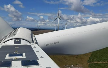
South Kyle II Wind Farm
South Kyle II Wind Farm is a proposed onshore wind farm east of Dalmellington, East Ayrshire on a site adjacent to the now operational South Kyle Wind Farm.
In May 2025, the project was submitted to the Scottish Government’s Energy Consents Unit, detailing the potential for a wind farm of up to 11 turbines (each up to 200m tip height), plus battery storage and associated infrastructure.
The planning application was slightly amended in June 2026, with a refined site layout designed to enhance South Kyle II’s peatland protection and restoration plans. This followed additional on-site peat probing and a thorough environmental impact assessment. The Further Environmental Impact Assessment is now subject to a 30 day consultation at www.energyconsents.scot
About South Kyle II Wind Farm
The project’s proposals outline that South Kyle II Wind Farm could deliver:
- Enough electricity to meet the approximate annual domestic needs of around 80,000 average UK homes, based on standard assumptions.
- An estimated community benefits package of over £18 million over 40 years, subject to ongoing consultation.
- Local employment and skills development opportunities.
- Local supply chain opportunities.
- Local rates revenue.
- Planned biodiversity measures including replanting, peat restoration and habitat creation.
If consented, South Kyle II could become Vattenfall’s third major investment in south-west Scotland, following South Kyle Wind Farm (operational) and Quantans Hill Wind Farm (in planning).
Scroll down to view the full proposal documents. The application can also be viewed at Scottish Government - Energy Consents Unit where you can also respond to the current consultation.
UK Wind Energy Database (UKWED) | RenewableUK
Designing a wind farm that takes account of environmental and community considerations
Vattenfall’s proposals for South Kyle II Wind Farm have been developed over a three-year period. During this time, we consulted and engaged with both local and national stakeholders, while gathering and analysing extensive environmental data.
This work has produced a plan which aims to balance the need to generate renewable energy with local priorities of supporting jobs, communities and economic opportunities, while aiming to support habitat enhancement measures.
Supporting local suppliers
Between 2020 and 2023, Vattenfall’s development of South Kyle Wind Farm resulted in significant investment with businesses based in Ayrshire and Dumfries and Galloway [source: Biggar Economics].
As we progress with South Kyle II, we aim to continue engaging with local suppliers. If you would like to be considered, please use this form to join our Supplier Directory.
In December 2025, Vattenfall signalled its ongoing support for the Ayrshire economy by becoming a Platinum Partner with Ayrshire Chamber of Commerce. Following over a decade of active membership, we have elevated our collaboration with the region’s leading business organisation to the exclusive top tier. The commitment will see Vattenfall’s Ayrshire projects work closely with the Ayrshire Chamber to build local business awareness of onshore wind, develop local supply chain networks and highlight the growth opportunities being delivered by the renewable energy sector in south west Scotland. Simon Lejeune, Lead Project Development Manager at Vattenfall, commented: “Vattenfall is delighted to become Ayrshire Chamber of Commerce’s only renewable-energy sector Platinum Partner. They are one of the country’s most active business organisations and share our ambitions to see Ayrshire’s economy flourish through investment and innovation. We look forward to developing this strategic collaboration and in particular supporting Ayrshire businesses to grasp supply chain opportunities associated with major renewable investments such as South Kyle II Wind Farm.”
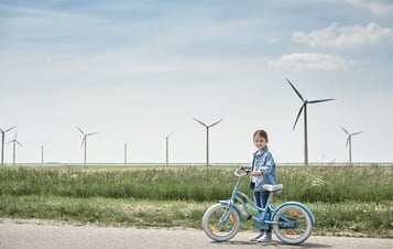
Community benefits
We are exploring options for how South Kyle II Wind Farm’s community benefits might respond to emerging local needs. In 2023, we established the South Kyle fund with Foundation Scotland, based on community wealth building principles, and are committed to engaging with communities to understand priorities.
We have met with the 9 Community Council Group (9CC Group), formed from nine communities within the Cumnock and Doon Valley area, as well as other local organisations, as we begin to explore options. Further discussions will follow in due course.
Click here to find out more about how Vattenfall develop Community Benefit Funds.
South Kyle II Additional Information Documents 2026
Reports and Notices:
| South Kyle II Wind Farm – FEI Report | Additional Information Public Notice |
Figures:
Technical Appendices:
South Kyle II Planning Submission Documents 2025
Volume 1 - EIAR Chapters
Volume 2a - EIAR Figures except LVIA
Volume 2b - EIAR Figures - LVIA
Volume 2c - EIAR Figures - LVIA and CH visualisations
Volume 3 - Technical Appendices
Volume 4 - Non Technical Summary
| Non Technical Summary |
Supporting Documents
| SK2 Planning and Renewable Energy Statement | |
| SK2 WF Skills and Employment Plan |
PACC Report
Public Notice
| SKII Public Notice |
South Kyle II Scoping Report Submitted 2022
*Wind Energy Statistics Explained on RenewableUK

News about the project
Why wind power?
Scotland has set its goal to reach net zero by 2045, and renewable energy projects such as this can play an important role in supporting the decarbonisation of homes, businesses and transport needed to reach this ambition. Onshore wind is expected to make a significant contribution, and newer turbine technology allows for greater efficiency and output compared to previous designs.
Onshore wind is widely recognised as one of the most cost-effective ways to generate electricity. Across the UK, there is already around 14GW of onshore wind capacity, making it a cornerstone of the UK energy mix. It is estimated that by 2030, 30GW of onshore wind generation will be required to meet climate targets at the lowest cost to consumers.
Onshore wind also brings benefits to host communities and the broader economy. We will offer community investment packages in line with Scottish Government guidance, enabling local communities to invest in priorities that matter to them. Across the economy, there are many opportunities for Scottish businesses to get involved. Vattenfall estimates that 70% of our onshore wind expenditure has been spent with British businesses, ranging from environmental studies and civil engineering through to site security and catering. If you think your business could supply these projects, please let us know.
Get In Touch
You can also email the development team directly here.
See also
South Kyle Wind Farm is a 50 turbine onshore wind project

Quantans Hill Wind Farm Proposal is an onshore wind farm project in South West Scotland

South Kyle II is a proposed onshore wind development of up to 17 turbines with a combined ...

As South Kyle Wind Farm takes shape, Vattenfall is shining the spotlight on our local supp...
We invest over £3mn into the local communities hosting our wind farm projects each year.